Robotics / Geometry / Webots
From readings
to structure.
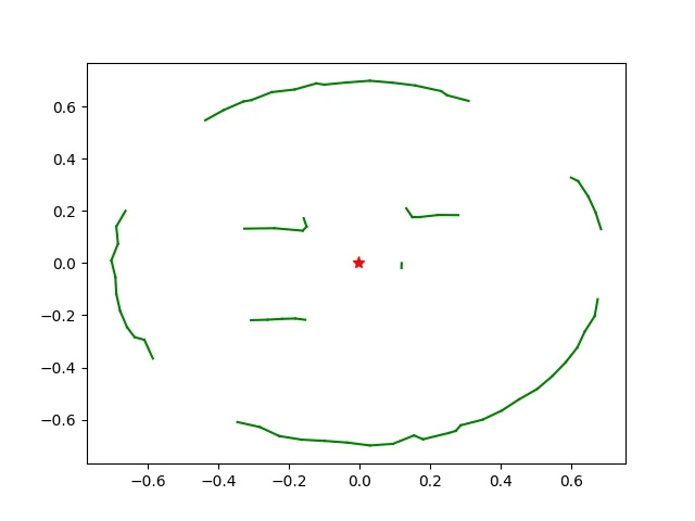
A split-and-merge mapping experiment: using geometry to turn a robot’s distance-sensor observations into a more compact description of its surroundings.
The question
A distance sensor gives individual observations. A map needs structure. This project explores how to move from one representation to the other, using the robot’s pose and a geometric line-fitting procedure.
The approach
- Interpret the sensors. Convert sensor outputs into distances using the lookup table and linear interpolation.
- Place the observations. Use the robot’s position and heading to express measurements as points in the environment.
- Split. Find the point with the greatest perpendicular distance from a candidate line; split a group when its deviation exceeds a threshold.
- Merge. Combine compatible segments to simplify the representation.
The engineering
The Webots controller brings together differential-drive kinematics, compass-based heading estimation, distance-sensor interpretation, and the split-and-merge procedure. NumPy and Matplotlib support the numerical work and inspection of the output.
I’m interested in this kind of problem because each layer matters: the interpretation of a sensor, the coordinate system, the geometry, and the final representation.